5 Great Road Cycling Rides Near Salt Lake City, Utah
5 Great Road Cycling Rides Near Salt Lake City, Utah
If you are a cyclist planning a trip to the Salt Lake City area, bring your bike!
Northern Utah offers a variety of terrain and beautiful scenery. Take in great climbing rides in the Wasatch Mountains, or choose a flatter option in the valley in and around the Great Salt Lake.
Here are 5 great bike rides that are favorites of local cyclists and visitors alike!
Emigration Canyon / Big Mountain Summit Salt Lake City Road Bike Ride
A suggested starting point for this ride is Liberty Park at 1300 South and 700 East in Salt Lake City. The park offers plenty of shady parking, and a spring fed water fountain to fill up your water bottles before or after your ride. Hop on your bike and head east up 900 South. After passing Contender Bicycles, jog left on 1100 East and right again on 800 South. You’ll have a couple of sharp climbs to warm up the legs, and then some gentle climbing to Hogle Zoo which is just outside the mouth to Emigration Canyon.
There is a restroom/water filling/bike maintenance station just East of the zoo at Rotary Glen Park if you need a rest before the real uphill starts.
The ride up Emigration Canyon is the 4th most popular riding route in the country, according to Strava.com data! You can compare your time against the 18,000 + other cyclists who have tackled this stretch of road. Once you make your way past Ruth’s Diner, and up the 1,294 feet of elevation gain, you’ll be treated to a great view of Little Dell Reservoir (see photo below).

If you’ve had enough riding for one day, this is a great turn around point, and it’s a downhill bike ride back to Salt Lake City. If you feel up for more of a challenge, continue east downhill, and take a left turn when you reach the stop sign at the bottom of the downhill section. This road will now take you to the Big Mountain Summit. This climb tops out at 7420 feet of elevation.
Ride Details
- Liberty Park to Big Mountain Summit & Back: Approximately 37 miles and 3750 feet of elevation gain.
- Vehicle traffic is moderate, heavier on weekends.
Little Cottonwood Canyon Bicycle Ride: Sandy, Utah
Sandy City is located in the Southern part of the Salt Lake valley and features one of the most challenging climbs for local cyclists and visitors to Utah. Frequently featured as part of the “Queen Stage” during the Tour of Utah bike race, Little Cottonwood Canyon has a well-earned reputation as a challenging climb.
A good recommended starting point for visitors from out of town is the Sandy Civic Center light rail station (115 East Sego Lily Drive, Sandy, UT 84070. From here, ride east on Sego Lily Drive to 1300 East and then take a left. Next, take a right turn on 9400 South, and this will lead you to the mouth of Little Cottonwood Canyon.
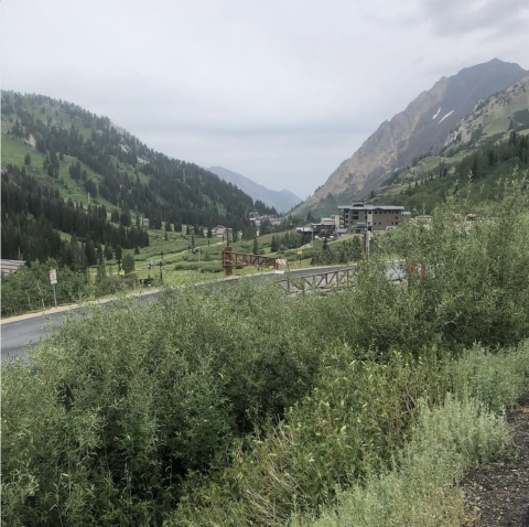
This climb is not easy! The road is steep, and averages 10% gradients for extended sections. From the start of the canyon to Snowbird Ski & Summer Resort the distance is 6.2 miles, and it is another 2.1 miles to the end of the paved road at Alta Ski Area, for a total distance of 8.3 miles.
There are great views of Mount Superior at the top, and both Snowbird and Alta are great destinations for Mountain Biking adventures.
Entry 2 at Snowbird will take you to the Snowbird Center, which has restroom facilities as well as places to refill water or purchase snacks for fuel. This is a good stop either on the way up, or down.
Ride Details
- Approximately 36.5 miles and 4500 feet of elevation gain.
- Vehicle traffic is moderate to heavy at times. Weekend canyon traffic can be especially busy when Oktoberfest is happening at Snowbird (weekends in August, September.)
Riding Your Bicycle on Antelope Island

Visitors to Utah often are curious about the Great Salt Lake. One great way to experience amazing views of the lake and see Utah wildlife is to ride a bicycle on Antelope Island. Visitors can expect to see bison with a very high probability. The island also features deer, antelope, a wealth of migratory bird species, as well as rare badger or coyote sightings.
This bike ride does not feature nearly as much altitude gain as the mountainous rides in Northern Utah, but there are a handful of small hills to navigate on the island.
A good place to start this ride is at the parking lot just outside of the causeway that leads to the island. The address is 4528 West, 1700 South; Syracuse, Utah 84075.
Note, all visitors to the island must have a State Park pass, and this includes cyclists. Day passes are available for $15 per person and can be purchased at the guard gate at the entrance to the island.
A popular route is to head west across the 7 mile pan-flat causeway, and then take a right at the fork in the road once reaching the island. This road will lead to the Antelope Island Visitor Center, which does have water available. Continuing on the road from the Visitor Center, it is a fun detour in the next fork in the road to take a right turn and ride the short climb to Buffalo Point. This offers a great view of the Great Salt Lake to the west, and bison can often be seen grazing in the distance from this vantage.
Going back downhill, continue straight at the fork in the road, but turn right at the next major road turn that heads to the Garr Ranch to the South. This road is mostly flat but has a few rolling hills and views of the Wasatch Front’s Davis County and Salt Lake County cities and mountains. At the end of this road is the Garr ranch, which visitors to the island can explore. Restrooms are also available here. Water filling is available in summer months, but not winter. Err on the side of bringing extra water just in case you are unable to fill up here.
Turning back to the north, follow the same road back to leave the island.
Ride Details
- Approximately 42 miles and 1300 feet of elevation gain.
- Utah State Park fee required.
- Depending on the season, there may be a large number of bugs (which do bite), especially on the road to/from the island and the marina area. Check https://stateparks.utah.gov/parks/antelope-island/current-conditions/ for current conditions.
Park City Empire Pass / Guardsman Pass Climbing Bike Ride
Park City, Utah is about 30 minutes east of Salt Lake City via Parley’s Canyon and has great high elevation cycling options. On a hot summer’s day, getting up to where temperatures are cooler is a favorite of locals as well as pro cyclists who often train in Park City. Peter Sagan and Quinn Simmons are two road bike racers who have expressed enjoyment riding in and around the Park City area. If you want a high-altitude climbing test, try this ride!
A good starting point is Utah Olympic Park. This was the venue for ski jumping at the 2002 Winter Olympics. From here, ride downhill until you reach UT-224 and turn right, riding towards Park City. Stay on this road for about 6 miles, and then turn left onto Deer Valley Drive. Stay on this road until the traffic circle, going straight this turns into Marsac Road. From here, follow the signs to Guardsman Pass, when in doubt keep going uphill!
The road is a steady, exposed climb until the Montage Park City hotel and then it gets very steep! Once reaching the summit of this climb (called Empire Pass), continue straight to reach Guardsman Pass which summits above the city of Brighton Utah at almost 9500 feet of elevation. There are great views at the top, and if you are a mountain biker, there are great trails that start from this location as well.
In many years there is still a lot of snow on Guardsman Pass. Check here to make sure the road is open before starting this ride.
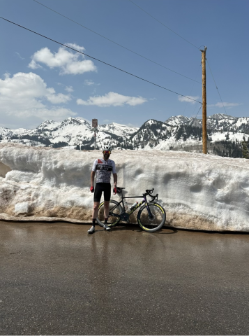
The downhill section back to Park City is fast, and some of the turns are sharp. Be careful, it is easy to lose track of how fast you are traveling on these roads.
Ride Details
- Approximately 31 miles
- About 3200 feet of elevation gain
- Know before you go: Upper Roads do not have winter maintenance and snow can take a long time to melt. Make sure the road is open before heading to the high elevation.
- Traffic: Moderate to low except during fall when leaves are changing and motorists go for scenic drives in the area.
Midway to the top of American Fork Canyon via Cascade Springs Road Bike Ride
A relatively new road that is a favorite among Utah riders already is a road that connects Midway, Utah to American Fork Canyon. This ride is especially popular in Autumn when the leaves are changing and the mountain side turns yellow, red, and orange.
To start this bike ride, a good recommended place is the Soldier Hollow Nordic Center. From here, you can start pedaling east and north for about a mile and a half, and then turn west on Route 220 / Cascade Springs drive. This climb starts a little steep, and then becomes more gradual. A nice feature of this bike climb is that there are a couple of brief downhill sections on route to the summit of American Fork Canyon. The road surface is new, and after reaching the summit if you are low on water you can descend a short distance to the Timpanogos Campground.
The views on this ride are stunning. You’ll be able to see the back side of Mount Timpanogos, which is a must-hike if you have time during your visit.
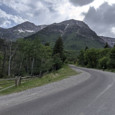
The total climb is about 12.5 miles and has over 3,300 feet of elevation gain. Your legs will know that you just did a hard bike ride! Also, keep your eyes peeled, there will be many deer along the way and you may even see a mountain goat if your timing is right!

Summary
Enjoy riding your bicycle in Utah and be safe out there!
